Upper and Netherlands
Where do you want to live in 2050?
Upper and Netherlands
Sea level 2020
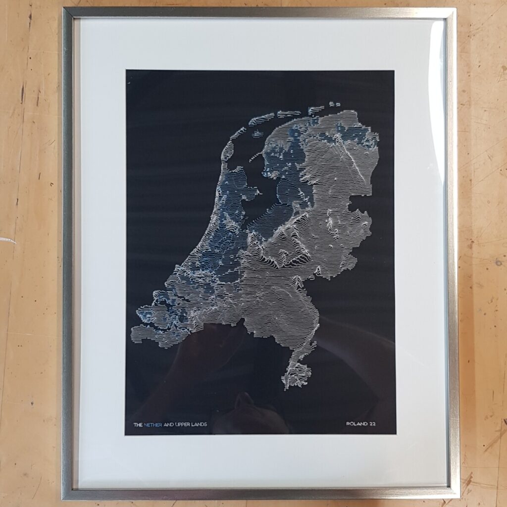
Upper and Netherlands is a generative study on the topology of the Netherlands. The Netherlands are very flat, but still there are higher places, like Limburg, the Utrechtse Heuvelrug and the Hondsrug. A Dutch person should be able to spot them.
The Netherlands are also called the Netherlands for a reason : they are low. Part of them even below the sea level. This becomes visible using an alternative colour for those regions.
Finally, the plotter-draw-bot is used to plot the picture. Using metallic silver and metallic blue the picture is put on black paper.
The nether and upperlands - Trilogy
Moving the study forward, a study is done what happens if the sea level rises. Should the Dutch people worry about achieving climate neutral 2050?
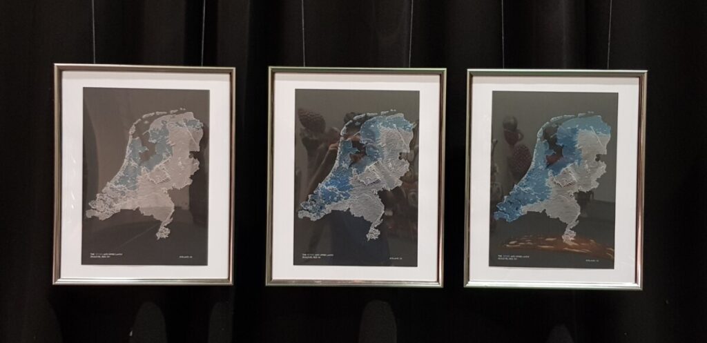
The trilogy plot “nether and upperlands 0 meter, 1 meter and 2 meter sea water level” is printed in limited edition of 10 times 3 on A3. It is for sale at €300. Send a DM for purchase.
The plot “upper and netherlands at sea water level” will be on reprint for €75. Send DM for request.
Used materials :
Pen : Gelly roll – Japan – metallic silver & metallic blue
Paper : Clairefontaine Pollen – 210 gram
Animation rising water
In the Netherlands dikes are built to protect the land from the sea. How long will this battle last? What if nature doesn’t care about losing or winning? How long will the will of the people hold when it costs everything you have and haven’t?
Using the power of animation, the country hight map is drawn as if there were no dikes. What is the sea-level prediction of the world climate forum?
Used Tools
Javascript (implement algo), Math (algo), Dutch Heightmap (Home | AHN) ,Inkscape (convert to G-Code), draw-bot (drawing)